| Stanford
Area Trails walk/run/bike/horse |
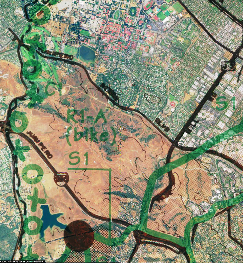
Trail S-1 is shown
in green as O-X-O (indicating "trail across private property"
in the County plan) at left. NotesTrail S-1 is clearly shown as running across Stanford land all the way from Sand Hill Road adjacent to the Stanford campus to the Arastadero Preserve area. The only difficult obstacle in the path of trail S-1 is the Stanford golf course, which can be bypassed on the east. Trail C-1 is shown following Matadero Creek, running through the Stanford Industrial Park at upper right, across a section of Stanford land east of Page Mill Road, along Old Page Mill Road, and crossing I-280 somewhere west of Page Mill Road. (The creek goes under I-280 in a pipe where the plan shows a trail crossing. A service road underpass exists slightly west(left) of the indicated crossing point, and the I-280/Page Mill interchange is to the right. There are no traffic control devices near the I-280/Page Mill interchange, Page Mill Road is a divided expressway in that area, and the on-ramp is two lanes wide, so trail crossings near that interchange would be dangerous.) The bright green strips at the upper left are golf fairways of the Stanford golf course. The black dashed line is the county line, with Santa Clara County on the right. The blue area at the lower left is Felt Lake. The areas to the left of Felt Lake and to the right of the dashed line which appear to have many tiny streets are parts of a tree farm, not a developed area. |