|
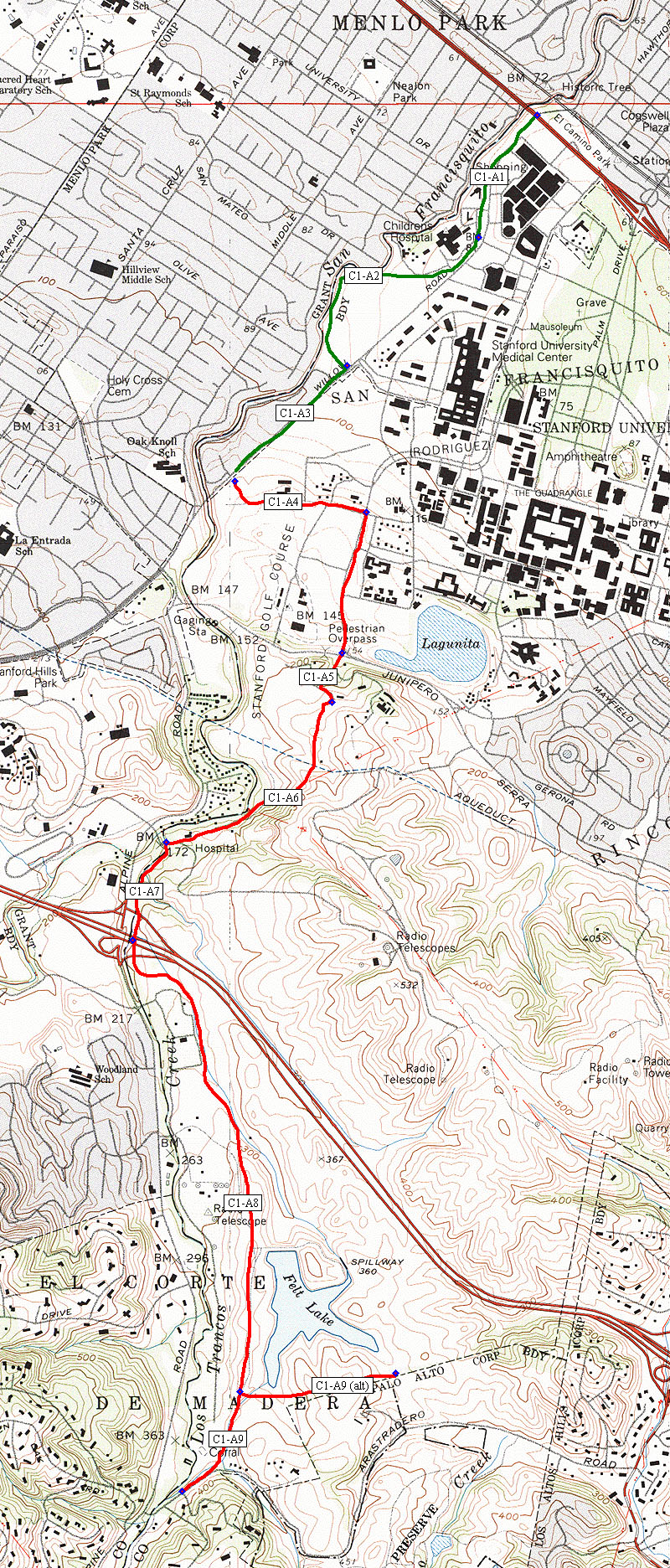
The map at
left shows our suggested trail route overlaid on a topographic
map.
Existing trail
segments in the urban area are shown in green. Proposed segments
are shown in red.
Click
on a segment below for a photo tour.
|
TRAIL OPTIONS
|
SEGMENTS OF THE PROPOSED
TRAIL OPTIONS
(from ___ to ___)
|
APPROX
LENGTH
(miles)
|
|
C1-A: San Francisquito/Los Trancos
Alignment Option
|
|
Segment
1
(C1-A1)
|
From El Camino Real to Arboretum Rd
|
.4
|
|
Segment
2
(C1-A2)
|
From Arboretum Rd to Pasteur Dr
|
.5 to .6
|
|
Segment
3
(C1-A3)
|
From Pasteur Dr to Searsville Path
|
.5
|
|
Segment
4*
(C1-A4)
|
From Searsville Path to Campus Drive
at Junipero Serra
|
1.0
|
|
Segment
5*
(C1-A5)
|
From Campus Drive at Junipero Serra
to end of Vista Drive at Golf Course.
|
0.25
|
|
Segment
6*
(C1-A6)
|
From end of Vista Drive to end of Piers
Lane
|
1.75
|
|
Segment 7*
(C1-A7)
|
From end of Piers Lane to Los Trancos
Creek south of I-280
|
0.3
|
|
Segment 8*
(C1-A8)
|
From Los Trancos Creek south of I-280
to Arastadero Road /creek vicinity.
|
2.0
|
|
Segment 9*
(C1-A9)
|
From Arastadero Road /creek vicinity
to DeAnza Trail.
|
.4
|
(The
photo tour is partially complete.)
Click
here, or on the map, for a much larger topo map.
Click
here for large scale aerial photos.
|