walk/run/bike/horse
|
Matadero Creek Link
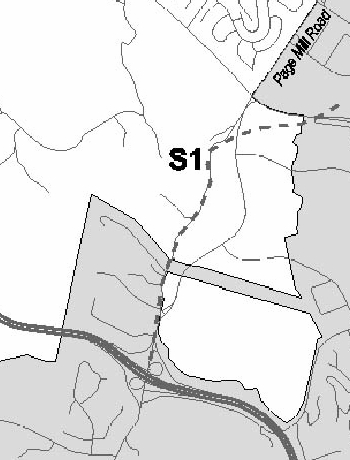
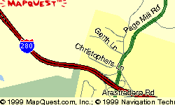
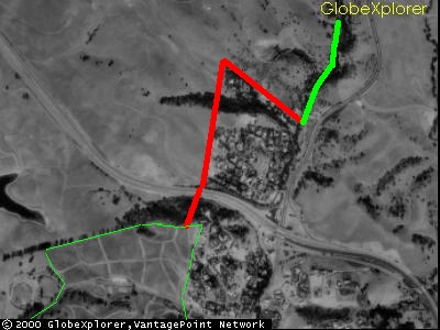
Proposed RoutingThis proposed routing is entirely within the City of Palo Alto. A narrow strip of Palo Alto connects the foothills with the valley. This strip is currently zoned PF- Public Facility by the City. Stanford is the property owner. The red section shown begins at Peter Coutts Tower, a brick cylinder
on Old Page Mill Road, and continues uphill alongside a residential
area of Los Altos Hills. The trail heads south at the top of a hill,
following an existing firebreak and merging with an existing paved
service road near I-280. South of I-280, the service road turns west, but the proposed trail routing would continue south to the Arastadero Preserve. This last section of trail is up a steep hill in a wooded area and would probably require switchbacks to protect the hillside from erosion. The trail problems are no worse, though, than those dealt with successfully elsewhere in the Arastadero Preserve. Additional Trail ConnectionsThere's an obvious opportunity to tie this trail into trails in the Stanford Dish area. Existing service roads are within a few hundred yards of the northernmost point of this trail. A connection would provide unbroken trail access from the Stanford campus to the Arastadero Preserve, offering a range of new recreational opportunities. |